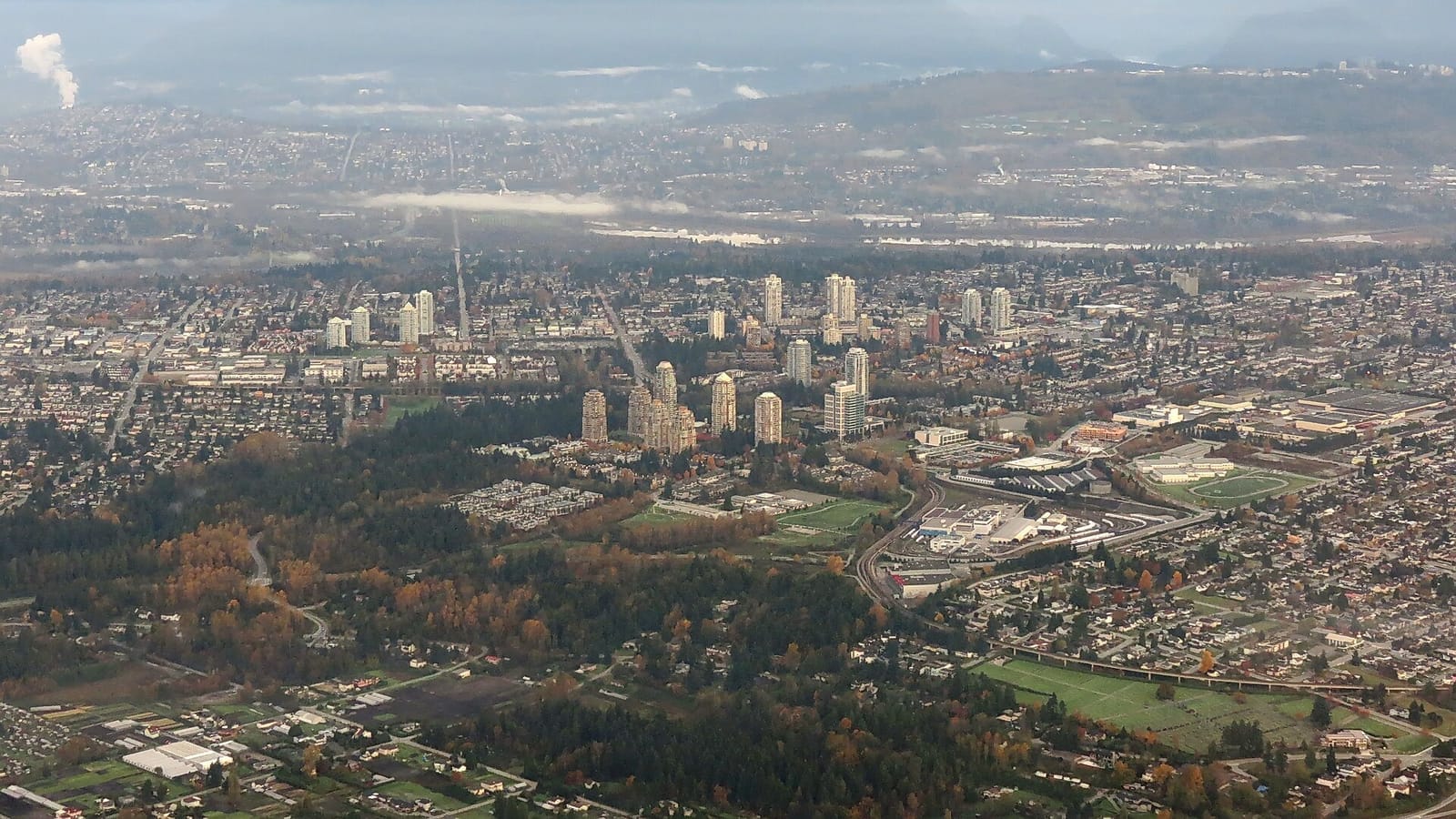
How Burnaby Got Its Names
Edmonds: a Dublin speculator who built a tramway to inflate his own land prices. Gilmore: a bureaucratic typo that replaced a politician's real name forever. Metrotown: a term borrowed from a Baltimore urban planning report. Sperling: it was Pole Line Road until someone renamed it after the electricity company's manager. Every name is an act of power somebody forgot to explain.
Henry Valentine Edmonds was born in Dublin on February 14, 1837 — Valentine's Day, for what it's worth. He arrived in British Columbia and became, in sequence, a deputy sheriff, a land speculator, a notary public, a justice of the peace, and a politician. The sequence matters. Each role fed the next. By the 1880s, Edmonds had accumulated real estate in Port Moody, Mount Pleasant, Burnaby, and Lulu Island.
In 1889, he began investing in street railway companies. Three of them. The Westminster and Vancouver Tramway Company, launched in 1891 with Vancouver Mayor David Oppenheimer, ran an interurban line that crossed directly through Burnaby. The Dictionary of Canadian Biography is blunt about his motives: the tramway "was clearly intended to increase the value of Edmonds's suburban lands."
The DCB's full assessment: Edmonds was "influential mainly as a suburban land promoter." He died on June 14, 1897, sixty years old, having successfully attached a transit line to his real estate holdings. The neighbourhood where the tramway ran still carries his name. Nobody in Edmonds today knows they live in a monument to a speculator's business plan.
Capitol Hill was another real estate play
Around 1909, brokerage firms subdivided a hillside in north Burnaby and named it after Rome's Capitoline Hill. Historian George Green documented the naming in "History of Burnaby and Vicinity." The classical reference was meant to suggest grandeur. The topography suggested otherwise.
The subdivision was platted without serious attention to the actual terrain. Many of the lots were too steep, too awkward, or too poorly drained to build on. Buyers defaulted. Twenty-two acres of unsold and abandoned lots eventually became Confederation Park. The neighbourhood got a Roman name and a public park out of the same failed speculation. Not a bad return on a con that didn't quite work.
Before the real estate agents arrived, L.I. Dundas had logged the hill in 1902, hauling timber out with oxen. The transition — from oxen dragging logs to agents selling fictional grandeur — took seven years.
A clerk misspelled a politician's name and nobody fixed it
Hugh Bowie Gilmour was a mechanical engineer who served as a provincial politician for Vancouver City from 1900 to 1903. At some point, a civic clerk transcribed his name and wrote "Gilmore" instead of "Gilmour." The error was never corrected.
Gilmore Avenue. Gilmore SkyTrain station. Gilmore Community School. An entire neighbourhood's identity rests on a typo. Gilmour, the actual man, left behind a minor political career. The clerk, whose name no one recorded, left behind a permanent alteration to the map of Burnaby.
There is probably a lesson in this about the relative durability of politicians and paperwork. The paperwork won.
Sperling Avenue was Pole Line Road
In 1903, the British Columbia Electric Railway Company began generating power at Buntzen Lake. On December 17 of that year, electricity first flowed through transmission lines strung on two wooden poles that followed the Barnet Wagon Road south into Burnaby. The road where the poles stood was called, with no poetry at all, Pole Line Road.
It was renamed after Rochfort Henry Sperling, the first General Superintendent and later General Manager of BCER, which had been incorporated in 1897. Sperling announced the Chilliwack interurban line in 1906. He was an administrator, an executive, a man who managed infrastructure. The road was given his name because naming things after executives was how British Columbia worked in the early twentieth century. It still is, mostly.
Pole Line Road was at least honest. You knew what was there. Sperling Avenue tells you nothing unless you already know the history of electrical transmission in the Lower Mainland, and almost nobody does.
Metrotown has never been a town
The word "metrotown" was coined in 1962 by the Baltimore Regional Planning Council. Urban economist R.W. Archer described the concept in a 1969 article in the American Journal of Economics and Sociology: "a unit for planned metropolitan development" — cohesive urban centres deployed radially around a central city, each accommodating 100,000 to 200,000 people.
In July 1974, Burnaby council designated the "Kingsway/Sussex town centre as a Metrotown development area." The planners had read the American literature. They borrowed the term. The term outlasted the planning theory that produced it.
Today, Metrotown is a SkyTrain station, a shopping mall, and a forest of residential towers. The bus loop smells like diesel and bubble tea. It accommodates well over the 100,000 people Archer envisioned. Whether it constitutes a "cohesive urban development" is a question best answered by anyone who has tried to cross Kingsway on foot during rush hour.
The imperial imports
Freeman Freeman-Thomas, 1st Marquess of Willingdon, served as Governor General of Canada from 1926 to 1931. He was the first GG to represent the Canadian Crown after the Balfour Declaration of 1926, which established the Dominions as autonomous communities. He was also the first to travel Canada by air. In 1931, King George V personally phoned to insist he accept the post of Viceroy of India.
Willingdon Avenue in Burnaby carries his name. He never lived here. He passed through. His name was affixed to a road in the colonial tradition of marking territory with the names of distant authority figures. The Marquess died in 1941, probably unaware that a street in a municipality east of Vancouver bore his title. Today it has a Superstore and a Petro-Canada and sixty thousand daily commuters who have never heard of him.
Royal Oak is older and stranger. The name traces to an English oak tree at Boscobel House where King Charles II hid from Parliamentary soldiers in 1651. The episode produced a legend, and the legend produced a naming convention. There are 467 pubs in Britain called The Royal Oak. Burnaby's Royal Oak neighbourhood predates Oakalla Prison, which opened there in 1912. Whether the neighbourhood was named for the English tree, one of the pubs, or a local oak that someone decided was royal — the record is unclear.
Stride Avenue remembers a councillor
Eber Stride served on Burnaby council from 1894 to 1913. Nineteen years. The avenue and Stride Avenue School, which opened in 1929, carry his name. He was a local politician who did local work for two decades. In the hierarchy of Burnaby place names — speculators, typos, distant aristocrats, planning jargon — a councillor who actually served the community for nineteen years feels like the most honest naming of the lot.
Cariboo Road goes back to gold
The name comes from the Cariboo Gold Rush of the 1860s. The original Cariboo Road was built between 1862 and 1865, stretching over 400 miles from Yale to Barkerville. Burnaby's Cariboo Road is a remnant, a piece of the route that once connected the coast to the goldfields. The gold is gone. The name persists. The road now connects a gas station to a strip mall, which is its own kind of decline narrative.
Brentwood is a guess
The origin of Brentwood as a Burnaby neighbourhood name is unconfirmed. It may derive from Brentwood in Essex, England, where the name meant "burnt wood" — a clearing made by fire, first recorded around 1177. No documentation has been found linking Burnaby's Brentwood to the English town with certainty. In 1957, Webb and Knapp Canada assembled a 572-home site in the area, but the name was already in use by then.
Some names come with paper trails. This one doesn't.
The map is an argument
Every neighbourhood name in Burnaby is a residue of someone's decision — a speculator's ambition, a clerk's careless penmanship, a planner's borrowed jargon, an empire's habit of stamping its officers onto foreign geography. The people who lived on the land before any of these names were assigned — the Squamish, Musqueam, and Tsleil-Waututh — had their own names for these places. Those names are mostly absent from the street signs.
What remains is a map that reads like a filing cabinet of accidents and intentions, none of them labelled. Edmonds built a tramway to sell real estate. A clerk couldn't spell Gilmour. A Baltimore planning report coined a word that ended up on a SkyTrain map. A road named for what it actually was — poles carrying electricity — got renamed after the manager who ran the company.
The names stay. The reasons dissolve. What the map records, in the end, is who had the authority to write on it.
Editor & Publisher
Artom Butenko
Founder and editor of 8 Pages Burnaby. Writes the fact-dense, archival pieces — origins, infrastructure, and the documents that explain how the city works.
More from May 2026
Full issue →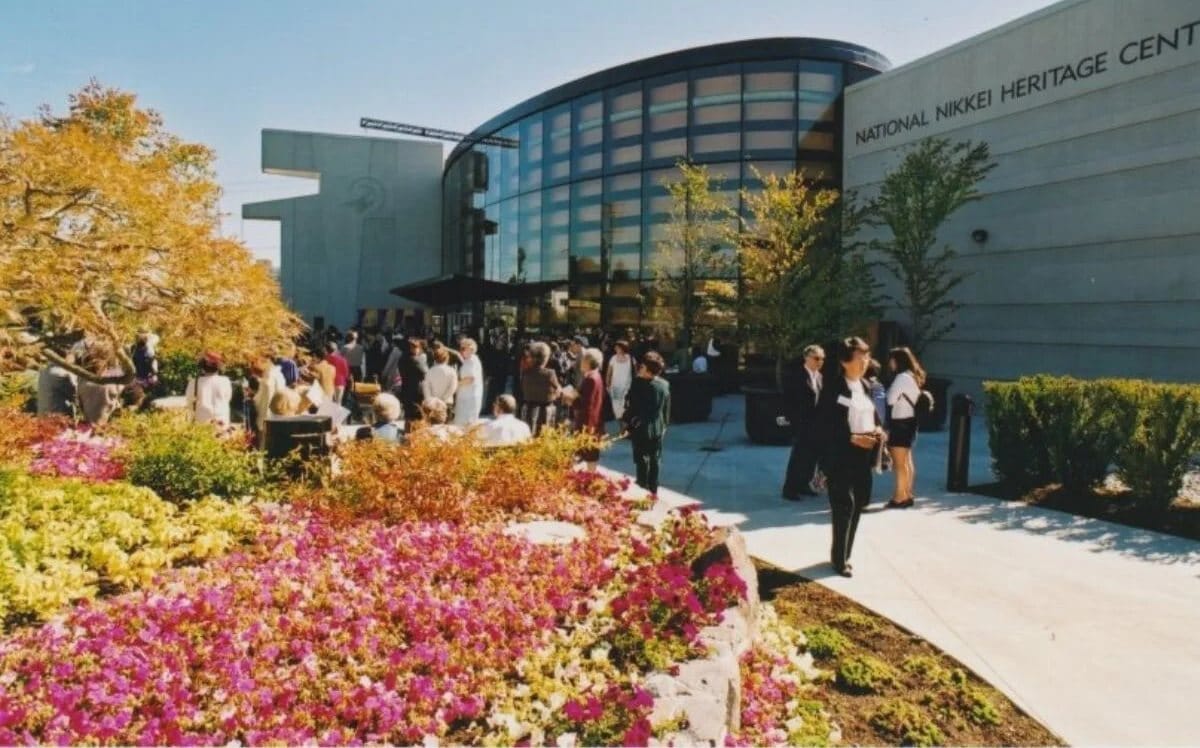
Nikkei Place: The Garden Built for Healing
The architect who designed the building was interned as a child. The land was purchased with redress money. The opening date was chosen to mark the anniversary of an apology. Inside are 670 recorded voices and 52,500 photographs from a community that lost everything and built this anyway.
Artom Butenko · 9 min read
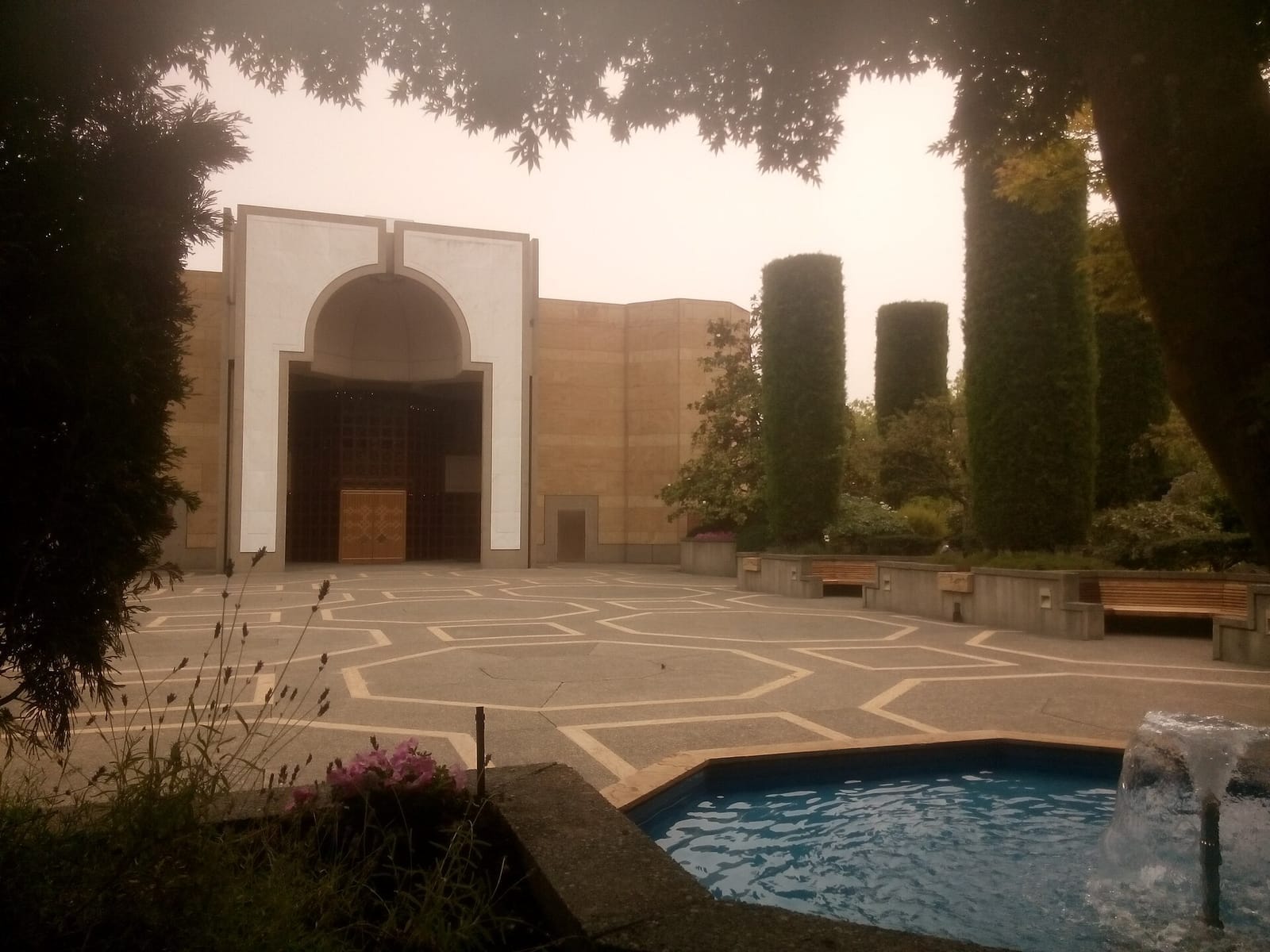
The Octagon on Canada Way: Inside Burnaby's Ismaili Centre
In 1985, the Aga Khan and the Prime Minister opened a building shaped like a prayer. Bruno Freschi designed it around a single geometric form — the octagon, "where the centre is everywhere, and everyone is in the centre." Thirteen years earlier, President Idi Amin had expelled the community that would fill it.
Artom Butenko · 6 min read

Ian James Corlett: The Man Who Made a Cartoon About His Street
He voiced Goku, left over a pay dispute, and went home to Burnaby to create a cartoon about growing up on Royal Oak Avenue. The piano store became a keyboard shop. The house became a drawing. The city became sixty-five episodes of a show that YTV aired for three years and then forgot.
Artom Butenko · 5 min read