Boundary Road: The Street That Marks Where the Great Fire Stopped
Boundary Road runs north-south for 11 kilometres through Metro Vancouver, separating Burnaby from Vancouver. The name comes from a municipal boundary drawn in 1891. But the road traces a line that mattered earlier—the eastern edge of the Great Vancouver Fire of 1886.
On June 13, 1886, Vancouver burned. The fire started around 2 p.m. near the shore of Burrard Inlet, in an area being cleared for construction. Workers were burning slash—branches, stumps, and undergrowth left from logging. The fire was initially under control, then it wasn’t. Wind picked up, embers spread, and within 45 minutes, most of the city was ablaze.
Vancouver was less than three months old. The city had incorporated on April 6, and its population was around 1,000. Most buildings were wooden—houses, hotels, saloons, general stores. Streets were unpaved. Water infrastructure was minimal. There was no organized fire department.
The fire moved west and south, driven by wind from the inlet, consuming the core of the settlement within an hour. Survivors ran toward water, cleared areas, or anything that wasn’t burning. Some jumped into the inlet. Others fled east, away from the densest settlement.
The fire stopped at approximately the line where Boundary Road now runs. Not precisely—fire doesn't follow straight lines—but close enough that when municipal boundaries were drawn five years later, the eastern edge of Vancouver's incorporated area roughly matched the eastern edge of where the city had burned.
The boundary wasn’t chosen because of the fire. But the fire shaped development, and development shaped where boundaries were drawn.
What Burned, What Didn’t
The Great Fire destroyed an estimated 400 buildings. Death toll estimates range from 20 to more than 50. Exact numbers were never confirmed. Some bodies were identified; others were not. Some missing people may have simply left the area.
The fire consumed most structures west of what is now Main Street and south of Hastings Street. East of the fire line—the area that would later become Burnaby—was less developed. Logging camps, small farms, and scattered settlement existed, but no dense clusters of buildings.
The eastern limit of the fire was determined by several factors. The wind shifted. The fuel—wooden buildings—became sparser as the fire moved east. Residents and workers created firebreaks by tearing down buildings in the fire's path. Rain may have started, though weather records from the day are incomplete.
Contemporary accounts place the fire’s stopping point near the area later occupied by the Pacific National Exhibition. East of that line, the land was forested or recently cleared. The fire burned out, or was stopped by firefighting efforts, or both. Records are unclear. By evening, the western part of the settlement was destroyed; the eastern part survived.
Rebuilding and Boundaries
Vancouver rebuilt quickly. Within weeks, new wooden buildings went up; within months, brick construction began. The city expanded rapidly, driven by the Canadian Pacific Railway’s decision to make Vancouver the western terminus of the transcontinental line, which arrived in May 1887.
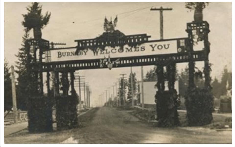
Population grew. By 1891, Vancouver had about 13,000 residents. The city’s boundaries needed formal definition. The area east of Vancouver incorporated as the District of Burnaby in 1892. The boundary between Vancouver and Burnaby followed a north-south line roughly along the eastern edge of Vancouver’s pre-fire settlement and post-fire rebuilding. That line became Boundary Road.
The name is straightforward: it marks the municipal boundary. But the location reflects a pattern of settlement shaped by the fire. Where people built—or didn’t build—after the disaster made the boundary logical.
What the Road Is Now
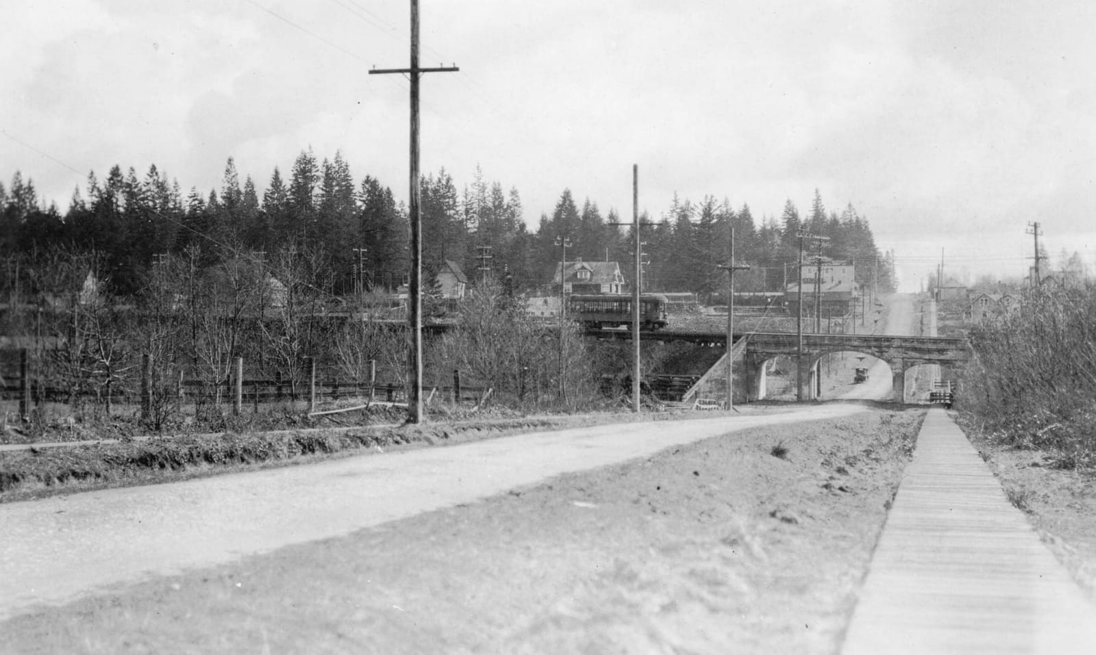
Boundary Road today is a major arterial route. It stretches from Burrard Inlet in the north to the Fraser River in the south, passing through residential, commercial, and industrial areas. Traffic is heavy. The road is four to six lanes for most of its length.
It marks the boundary between Vancouver and Burnaby: properties on the west side are in Vancouver; those on the east are in Burnaby. Services—garbage collection, water, utilities, policing—are provided by different municipalities depending on which side you are on.
For residents, the boundary matters administratively: property taxes, zoning, building permits. Yet the street itself is continuous. Crossing it rarely feels like crossing a boundary unless one pays attention to municipal signage.
Most residents know Boundary Road marks the city line. Fewer know its connection to the fire of 1886. There are no plaques. No markers explaining the connection. The fire is remembered in Vancouver—there's a small memorial at Maple Tree Square near where the fire started—but the eastern edge of the fire, the line where it stopped, has no commemoration.
Historical Memory and Geography
The Great Fire is part of Vancouver’s founding mythology. It destroyed the original settlement and forced a rebuild that shaped early development. Its geography is less remembered. The start of the fire and the downtown destruction are well-known; its eastern edge is not.
Boundary Road exists as a functional street, a municipal boundary, and a traffic route. Its connection to the fire is incidental to how people use it today. Cities tend to commemorate dramatic events rather than edges and limits. The line where something stopped is less visible than where it happened.
The Great Fire shaped Vancouver’s geography: building codes required brick and stone in commercial areas, streets were widened, and water infrastructure improved. Burnaby, east of the fire line, developed differently. Without the pressure of immediate rebuilding, settlement remained sparse through the 1890s. The interurban railway, which arrived in the late 1890s, shaped Burnaby's growth more than the fire did.
The boundary between Vancouver and Burnaby, which became Boundary Road, reflects where settlement occurred immediately after the fire. The fire didn’t create the boundary, but it shaped settlement patterns that made the boundary logical.
Today, Boundary Road is a busy street. Most cross it without thinking about June 13, 1886. The fire is history. The boundary is administration. The street is infrastructure.
But the line is there, running north-south for 11 kilometres, marking the edge of what burned and what didn't.
And remember: you can always support your local firefighters by donating. Visit Burnaby Firefighters
Editor & Publisher
Artom Butenko
Founder and editor of 8 Pages Burnaby. Writes the fact-dense, archival pieces — origins, infrastructure, and the documents that explain how the city works.
More from January 2026
Full issue →
Robert Burnaby: The Private Secretary Who Became a City
In 1859, Colonel Richard Moody named a lake after his private secretary. Who was Robert Burnaby, and why does his name still echo across this city?
Artom Butenko · 6 min read
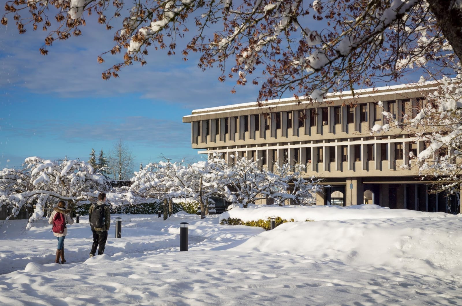
What the Burnaby Mountain Holds: SFU in Winter
Arthur Erickson's mountaintop campus becomes something else in January—a stark landscape of shadows and ice that Hollywood keeps casting as the future.
Ilarion Bohatyrov · 6 min read
The Beginning of Burnaby
On September 22, 1892, a scattered collection of farms and logging camps voted to become something more. What changed when Burnaby broke away from New Westminster?
Artom Butenko · 8 min read